Kategoritë në Quesada
Kisha e Asambleve të PerëndisëKishatDyqani i kompjuteraveDyqan Pajisjesh ShtëpiakeZhvillim banimiArsimBare, pubs dhe tavernatDyqane ushqimore dhe supermarkete KafeneRestorantetBankaKompleks banimiKompleks KondominiumeshDyqani i librave dhe stendat e rejafarmaciPazarParqet PublikeShesh lojërashHotele dhe moteleShoqatë Strehimi
Industries
Shpërndarja e bizneseve sipas industrisë në Quesada
| Përshkrimi i industrisë | Numri i ndërmarrjeve |
|---|---|
| Dyqane ushqimore dhe supermarkete | 21 |
| Kishat | 18 |
| Restorantet | 16 |
| Pazar | 11 |
| Arsim | 11 |
| Dyqani i kompjuterave | 6 |
| Riparimi i makinave | 5 |
| Hotele dhe motele | 5 |
| Farmacitë dhe dyqane të drogës | 5 |
Faktet për Quesada
| zonë | 117.4 km² |
| Popullsia | 27 169 |
| Popullsia mashkullore | 13 274 (48.9%) |
| Popullsia femra | 13 895 (51.1%) |
| Ndryshimi i popullsisë (1975 to 2020) | +212.7% |
| Ndryshimi i popullsisë (2000 to 2020) | +50.8% |
| Mosha mesatare | 18.6 vjet (Mashkull: 17.8, Femër: 19.5) |
| Ora lokale | |
| Zona e orës | Ora standarde e SHBA-së Qendrore |
| Gjer. dhe gjat. | 14.27028, -90.04028 |
| Kodet Postare | 22017 |
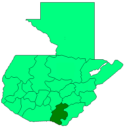
Harta e Quesada
Harta interaktive
Popullsia e Quesada
Vitet 1975 në 2020
| Data | 1975 | 1990 | 2000 | 2015 | 2020 |
|---|---|---|---|---|---|
| Popullsia | 8689 | 14 161 | 18 019 | 24 387 | 27 169 |
| Dendësia e popullsisë | 74 / km² | 120,6 / km² | 153,4 / km² | 207,7 / km² | 231,3 / km² |
Burimet: JRC (European Commission's Joint Research Centre) puna mbi GHS built-up grid
Ndryshimi i popullsisë së Quesada nga 2000 në 2015
Rritje prej 35.3% nga viti 2000 në 2015
| Vendndodhja | Ndryshimi nga 1975 | Ndryshimi nga 1990 | Ndryshimi nga 2000 |
|---|---|---|---|
| Quesada | +180.7% | +72.2% | +35.3% |
| Departamento de Jutiapa | +125.2% | +61.2% | +31.3% |
| Guatemala | +161.9% | +78.4% | +39.8% |
Burimet: JRC (European Commission's Joint Research Centre) puna mbi GHS built-up grid
Mosha mediane e Quesada
Mosha mediane: 18.6 vjet
| Vendndodhja | Mosha mesatare | Mosha Mediane (Femër) | Mosha mesatare (Mashkull) |
|---|---|---|---|
| Quesada | 18.6 yrs | 19.5 yrs | 17.8 yrs |
| Departamento de Jutiapa | 18.7 yrs | 19.5 yrs | 17.8 yrs |
| Guatemala | 18.6 yrs | 19.5 yrs | 17.8 yrs |
Burimet: CIESIN (Center for International Earth Science Information Network)
Dendësia e popullsisë së Quesada
Dendësia e popullsisë: 231 / km²
| Vendndodhja | Popullsia | zonë | Dendësia |
|---|---|---|---|
| Quesada | 27 169 | 117,4 km² | 231 / km² |
| Departamento de Jutiapa | 470 782 | 3305,1 km² | 142 / km² |
| Guatemala | 16,3 million | 109 009,9 km² | 149 / km² |
Burimet: JRC (European Commission's Joint Research Centre) puna mbi GHS built-up grid
Popullsia historike dhe e projektuar e Quesada
Popullsia e vlerësuar nga 900 në 2100
Burimet:
- JRC (European Commission's Joint Research Centre) puna mbi GHS built-up grid
- CIESIN (Center for International Earth Science Information Network)
- [lidhje] Klein Goldewijk, K., Beusen, A., Doelman, J., and Stehfest, E.: Anthropogenic land use estimates for the Holocene – HYDE 3.2, Earth Syst. Sci. Data, 9, 927–953, https://doi.org/10.5194/essd-9-927-2017, 2017.
Indeksi i Zhvillimit Njerëzor (HDI)
Indeksi i përbërë statistikor i jetëgjatësisë, arsimimit dhe të ardhurave për frymë.
Burimi: [lidhje] Kummu, M., Taka, M. &Guillaume, J. Gridded global datasets for Gross Domestic Product and Human Development Index over 1990–2015. Sci Data 5, 180004 (2018) doi:10.1038/sdata.2018.4
Emetimet e CO2 të Quesada
Emisionet e dioksidit të karbonit (CO2) për frymë në ton në vit
| Vendndodhja | Emetimet e CO2 | Emetimet e CO2 për frymë | Intensiteti i emetimeve të CO2 |
|---|---|---|---|
| Quesada | 31,059 tn | 1.14 tn | 264.5 tons/km² |
| Departamento de Jutiapa | 538,598 tn | 1.14 tn | 163 tons/km² |
| Guatemala | 17,248,451 tn | 1.06 tn | 158.2 tons/km² |
Burimet: [lidhje] Moran, D., Kanemoto K; Jiborn, M., Wood, R., Többen, J., and Seto, K.C. (2018) Carbon footprints of 13,000 cities. Environmental Research Letters DOI: 10.1088/1748-9326/aac72a
Emetimet e CO2 të Quesada
| Emetimet e CO2 për 2013 (tonë/vit) | 31,059 tn |
| Emetimet e CO2 për 2013 (tonë/vit) për frymë | 1.14 tn |
| Intensiteti i emetimeve të CO2 për 2013 (tonë/km²/vit) | 264.5 tons/km² |
Rreziku natyror i rreziqeve
Relative risk out of 10
| Rrezik | Risk Level |
|---|---|
| Drought | High (10) |
| Flood | High (10) |
| Earthquake | Medium (7) |
| Landslide | High (9) |
* Risk, particularly concerning flood or landslide, may not be for the entire area.
Burimet:
- Dilley, M., R.S. Chen, U. Deichmann, A.L. Lerner-Lam, M. Arnold, J. Agwe, P. Buys, O. Kjekstad, B. Lyon, and G. Yetman. 2005. Natural Disaster Hotspots: A Global Risk Analysis. Washington, D.C.: World Bank. https://doi.org/10.1596/0-8213-5930-4.
- Center for Hazards and Risk Research - CHRR - Columbia University, Center for International Earth Science Information Network - CIESIN - Columbia University, and Norwegian Geotechnical Institute - NGI. 2005. Global Landslide Hazard Distribution. Palisades, NY: NASA Socioeconomic Data and Applications Center (SEDAC). https://doi.org/10.7927/H4P848VZ.
- Center for Hazards and Risk Research - CHRR - Columbia University, Center for International Earth Science Information Network - CIESIN - Columbia University, and International Research Institute for Climate and Society - IRI - Columbia University. 2005. Global Drought Hazard Frequency and Distribution. Palisades, NY: NASA Socioeconomic Data and Applications Center (SEDAC). https://doi.org/10.7927/H4VX0DFT.
- Center for Hazards and Risk Research - CHRR - Columbia University, Center for International Earth Science Information Network - CIESIN - Columbia University. 2005. Global Flood Hazard Frequency and Distribution. Palisades, NY: NASA Socioeconomic Data and Applications Center (SEDAC). https://doi.org/10.7927/H4668B3D.
- Center for Hazards and Risk Research - CHRR - Columbia University, Center for International Earth Science Information Network - CIESIN - Columbia University. 2005. Global Earthquake Hazard Distribution - Peak Ground Acceleration. Palisades, NY: NASA Socioeconomic Data and Applications Center (SEDAC). https://doi.org/10.7927/H4BZ63ZS.
Tërmetet e fundit pranë
Madhësia 3.0 dhe më e madhe
| Data▼ | Ora↕ | Magnitude↕ | Distance↕ | Thellesi↕ | Vendndodhja↕ | lidhje |
|---|---|---|---|---|---|---|
| 12/20/18 | 5:01 PM | 4.6 | 25.8 km | 165,540 m | 5km NE of San Juan Tecuaco, Guatemala | usgs.gov |
| 5/27/18 | 7:16 PM | 4.4 | 17.7 km | 188,830 m | 3km SE of Jutiapa, Guatemala | usgs.gov |
| 4/25/18 | 10:18 PM | 4.9 | 5.1 km | 192,890 m | 5km ENE of Quesada, Guatemala | usgs.gov |
| 4/21/18 | 11:14 AM | 4.4 | 25.5 km | 193,230 m | 4km SSE of Nueva Santa Rosa, Guatemala | usgs.gov |
| 1/10/18 | 3:43 PM | 4.1 | 20.6 km | 246,210 m | 11km SW of Monjas, Guatemala | usgs.gov |
| 1/15/17 | 2:13 PM | 4.6 | 21.4 km | 211,920 m | 6km ESE of Casillas, Guatemala | usgs.gov |
| 10/9/16 | 10:55 PM | 4.8 | 10.3 km | 195,820 m | 4km N of San Jose Acatempa, Guatemala | usgs.gov |
| 8/14/16 | 5:13 AM | 4.8 | 33.3 km | 139,100 m | 10km N of Tacuba, El Salvador | usgs.gov |
| 2/14/16 | 8:18 AM | 4.6 | 29.6 km | 166,910 m | 4km S of Santa Rosa de Lima, Guatemala | usgs.gov |
| 2/1/16 | 4:45 PM | 4.5 | 32.5 km | 130,720 m | 10km N of Tacuba, El Salvador | usgs.gov |
Burimi: U.S. Geological Survey (USGS)


Rreth të dhënave tona
Të dhënat në këtë faqe janë vlerësuar duke përdorur një numër veglash dhe burimesh të disponueshme publike. Ofrohen pa garanci dhe mund të përmbajnë pasaktësi. Përdorni në rrezikun tuaj.