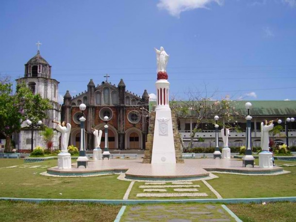
Kategoritë në Libon
Pikë karburantiRiparimin motorBujqёsiMulli OriziDyqane rrobash BesimiKishatQendër KomunitareZyrë QeveritareZhvillim banimiArsimShkollë e mesmeShkollë filloreAtraksion TuristikDyqane ushqimore dhe supermarkete Furra bukeKafeneKafenetëRestorantetRestorante të ushqimit të shpejtëBankaQendër shëndetësore komunitareVarrezaBerberëShtypshkronjëKompleks banimiDyqane komoditetDyqan i përgjithshëmfarmaciPazarShesh lojërashResort HotelShoqatë Strehimi
Industries
Shpërndarja e bizneseve sipas industrisë në Libon
| Përshkrimi i industrisë | Numri i ndërmarrjeve |
|---|---|
| Arsim | 70 |
| Pazar | 22 |
| Administrimi publik | 18 |
| Besimi | 17 |
| Restorantet | 14 |
| Dyqane ushqimore dhe supermarkete | 13 |
| Kishat | 13 |
| Strehim Tjera | 11 |
Faktet për Libon
| zonë | 168.3 km² |
| Popullsia | 73 746 |
| Popullsia mashkullore | 37 878 (51.4%) |
| Popullsia femra | 35 868 (48.6%) |
| Ndryshimi i popullsisë (1975 to 2020) | +375.0% |
| Ndryshimi i popullsisë (2000 to 2020) | +37.7% |
| Mosha mesatare | 19.8 vjet (Mashkull: 19.5, Femër: 20.3) |
| Prefikset Telefon | 52 |
| Lagjet | Buga, Poblacion, San Vicente, Sagrada Familia |
| Ora lokale | |
| Zona e orës | Ora standarde e Filipineve |
| Gjer. dhe gjat. | 13.29970, 123.43860 |
| Kodet Postare | 4507 |
Harta e Libon
Harta interaktive
Popullsia e Libon
Vitet 1975 në 2020
| Data | 1975 | 1990 | 2000 | 2015 | 2020 |
|---|---|---|---|---|---|
| Popullsia | 15 526 | 38 663 | 53 561 | 67 885 | 73 746 |
| Dendësia e popullsisë | 92,3 / km² | 229,8 / km² | 318,3 / km² | 403,5 / km² | 438,3 / km² |
Burimet: JRC (European Commission's Joint Research Centre) puna mbi GHS built-up grid
Ndryshimi i popullsisë së Libon nga 2000 në 2015
Rritje prej 26.7% nga viti 2000 në 2015
| Vendndodhja | Ndryshimi nga 1975 | Ndryshimi nga 1990 | Ndryshimi nga 2000 |
|---|---|---|---|
| Libon | +337.2% | +75.6% | +26.7% |
| Filipinet | +146.5% | +63.3% | +29.5% |
Burimet: JRC (European Commission's Joint Research Centre) puna mbi GHS built-up grid
Mosha mediane e Libon
Mosha mediane: 19.8 vjet
| Vendndodhja | Mosha mesatare | Mosha Mediane (Femër) | Mosha mesatare (Mashkull) |
|---|---|---|---|
| Libon | 19.8 yrs | 20.3 yrs | 19.5 yrs |
| Filipinet | 23.2 yrs | 23.6 yrs | 22.8 yrs |
Burimet: CIESIN (Center for International Earth Science Information Network)
Dendësia e popullsisë së Libon
Dendësia e popullsisë: 438 / km²
| Vendndodhja | Popullsia | zonë | Dendësia |
|---|---|---|---|
| Libon | 73 746 | 168,3 km² | 438 / km² |
| Filipinet | 96,6 million | 296 939,4 km² | 325 / km² |
Burimet: JRC (European Commission's Joint Research Centre) puna mbi GHS built-up grid
Popullsia historike dhe e projektuar e Libon
Popullsia e vlerësuar nga 1860 në 2100
Burimet:
- JRC (European Commission's Joint Research Centre) puna mbi GHS built-up grid
- CIESIN (Center for International Earth Science Information Network)
- [lidhje] Klein Goldewijk, K., Beusen, A., Doelman, J., and Stehfest, E.: Anthropogenic land use estimates for the Holocene – HYDE 3.2, Earth Syst. Sci. Data, 9, 927–953, https://doi.org/10.5194/essd-9-927-2017, 2017.
Prefikset Telefon
Kodet e zonave të përqindjes që përdoren nga bizneset në Libon
Indeksi i Zhvillimit Njerëzor (HDI)
Indeksi i përbërë statistikor i jetëgjatësisë, arsimimit dhe të ardhurave për frymë.
Burimi: [lidhje] Kummu, M., Taka, M. &Guillaume, J. Gridded global datasets for Gross Domestic Product and Human Development Index over 1990–2015. Sci Data 5, 180004 (2018) doi:10.1038/sdata.2018.4
Emetimet e CO2 të Libon
Emisionet e dioksidit të karbonit (CO2) për frymë në ton në vit
| Vendndodhja | Emetimet e CO2 | Emetimet e CO2 për frymë | Intensiteti i emetimeve të CO2 |
|---|---|---|---|
| Libon | 82,975 tn | 1.13 tn | 493.2 tons/km² |
| Filipinet | 104,920,564 tn | 1.09 tn | 353.3 tons/km² |
Burimet: [lidhje] Moran, D., Kanemoto K; Jiborn, M., Wood, R., Többen, J., and Seto, K.C. (2018) Carbon footprints of 13,000 cities. Environmental Research Letters DOI: 10.1088/1748-9326/aac72a
Emetimet e CO2 të Libon
| Emetimet e CO2 për 2013 (tonë/vit) | 82,975 tn |
| Emetimet e CO2 për 2013 (tonë/vit) për frymë | 1.13 tn |
| Intensiteti i emetimeve të CO2 për 2013 (tonë/km²/vit) | 493.2 tons/km² |
Rreziku natyror i rreziqeve
Relative risk out of 10
| Rrezik | Risk Level |
|---|---|
| Drought | Medium (5) |
| Flood | Medium (7) |
| Earthquake | High (8) |
| Cyclone | High (10) |
| Landslide | High (8) |
* Risk, particularly concerning flood or landslide, may not be for the entire area.
Burimet:
- Dilley, M., R.S. Chen, U. Deichmann, A.L. Lerner-Lam, M. Arnold, J. Agwe, P. Buys, O. Kjekstad, B. Lyon, and G. Yetman. 2005. Natural Disaster Hotspots: A Global Risk Analysis. Washington, D.C.: World Bank. https://doi.org/10.1596/0-8213-5930-4.
- Center for Hazards and Risk Research - CHRR - Columbia University, Center for International Earth Science Information Network - CIESIN - Columbia University, and Norwegian Geotechnical Institute - NGI. 2005. Global Landslide Hazard Distribution. Palisades, NY: NASA Socioeconomic Data and Applications Center (SEDAC). https://doi.org/10.7927/H4P848VZ.
- Center for Hazards and Risk Research - CHRR - Columbia University, Center for International Earth Science Information Network - CIESIN - Columbia University, International Bank for Reconstruction and Development - The World Bank, and United Nations Environment Programme Global Resource Information Database Geneva - UNEP/GRID-Geneva. 2005. Global Cyclone Hazard Frequency and Distribution. Palisades, NY: NASA Socioeconomic Data and Applications Center (SEDAC). https://doi.org/10.7927/H4CZ353K.
- Center for Hazards and Risk Research - CHRR - Columbia University, Center for International Earth Science Information Network - CIESIN - Columbia University, and International Research Institute for Climate and Society - IRI - Columbia University. 2005. Global Drought Hazard Frequency and Distribution. Palisades, NY: NASA Socioeconomic Data and Applications Center (SEDAC). https://doi.org/10.7927/H4VX0DFT.
- Center for Hazards and Risk Research - CHRR - Columbia University, Center for International Earth Science Information Network - CIESIN - Columbia University. 2005. Global Flood Hazard Frequency and Distribution. Palisades, NY: NASA Socioeconomic Data and Applications Center (SEDAC). https://doi.org/10.7927/H4668B3D.
- Center for Hazards and Risk Research - CHRR - Columbia University, Center for International Earth Science Information Network - CIESIN - Columbia University. 2005. Global Earthquake Hazard Distribution - Peak Ground Acceleration. Palisades, NY: NASA Socioeconomic Data and Applications Center (SEDAC). https://doi.org/10.7927/H4BZ63ZS.
Tërmetet e fundit pranë
Madhësia 3.0 dhe më e madhe
| Data▼ | Ora↕ | Magnitude↕ | Distance↕ | Thellesi↕ | Vendndodhja↕ | lidhje |
|---|---|---|---|---|---|---|
| 5/14/19 | 1:36 AM | 4.3 | 63.8 km | 35,000 m | 13km NW of Monreal, Philippines | usgs.gov |
| 3/19/19 | 2:59 AM | 4.2 | 76.3 km | 113,590 m | 2km N of Casiguran, Philippines | usgs.gov |
| 12/6/18 | 9:26 AM | 4.2 | 70.4 km | 64,430 m | 1km NE of Sorsogon, Philippines | usgs.gov |
| 11/5/17 | 3:36 PM | 4.6 | 46.1 km | 54,840 m | 4km E of Maslog, Philippines | usgs.gov |
| 9/21/17 | 3:39 AM | 4.5 | 56.1 km | 36,420 m | 6km ESE of Mabiton, Philippines | usgs.gov |
| 7/30/17 | 3:31 PM | 4.4 | 65.8 km | 76,320 m | 1km SSE of Capuy, Philippines | usgs.gov |
| 1/11/17 | 6:24 AM | 4.8 | 74.7 km | 75,030 m | 17km S of Calolbon, Philippines | usgs.gov |
| 1/2/17 | 5:36 PM | 4.2 | 77.7 km | 10,370 m | 10km NNE of Aroroy, Philippines | usgs.gov |
| 1/13/16 | 8:46 PM | 4.2 | 26.1 km | 35,000 m | 5km NNE of Cagmanaba, Philippines | usgs.gov |
| 5/13/15 | 5:00 PM | 4.5 | 74.5 km | 56,900 m | 8km NE of Bacon, Philippines | usgs.gov |
Burimi: U.S. Geological Survey (USGS)


Rreth të dhënave tona
Të dhënat në këtë faqe janë vlerësuar duke përdorur një numër veglash dhe burimesh të disponueshme publike. Ofrohen pa garanci dhe mund të përmbajnë pasaktësi. Përdorni në rrezikun tuaj.