| Zona e Gray, Iowa | 1 mi² |
| Popullsia | 60 |
| Ndryshimi i popullsisë nga 1975 në 2015 | +36,4% |
| Ndryshimi i popullsisë nga 2000 në 2015 | -15,5% |
| Prefikset Telefon | 712 |
| Ora lokale | e shtunë 10:54 m.d. |
| Zona e orës | Ora verore e SHBA-së Qendrore |
| Gjer. dhe gjat. | 41.83943° / -94.98304° |
| Kodet Postare | 50110 |
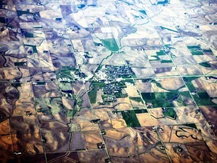
Gray, Iowa Popullsia
Vite 1975 deri 2015Sources: JRC (European Commission's Joint Research Centre) work on the GHS built-up gridGray Ndryshimi i popullsisë nga 2000 në 2015
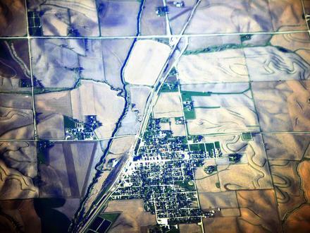
Ulja e 15,5% nga viti 2000 në 2015Sources: JRC (European Commission's Joint Research Centre) work on the GHS built-up gridGray, Iowa Dendësia e popullsisë
Dendësia e popullsisë: 60,0 / mi²Sources: JRC (European Commission's Joint Research Centre) work on the GHS built-up gridIndeksi i Zhvillimit Njerëzor (HDI)
Indeksi i përbërë statistikor i jetëgjatësisë, arsimimit dhe të ardhurave për frymë.Sources: [Link] Kummu, M., Taka, M. & Guillaume, J. Gridded global datasets for Gross Domestic Product and Human Development Index over 1990–2015. Sci Data 5, 180004 (2018) doi:10.1038/sdata.2018.4Emetimet e CO2 Gray, Iowa
Emisionet e dioksidit të karbonit (CO2) për frymë në ton në vitSources: [lidhje] Moran, D., Kanemoto K; Jiborn, M., Wood, R., Többen, J., and Seto, K.C. (2018) Carbon footprints of 13,000 cities. Environmental Research Letters DOI: 10.1088/1748-9326/aac72aEmetimet e CO2 Gray, Iowa
| Emetimet e CO2 2013 (ton / vit) | 1 150 tn |
| Emetimet e CO2 2013 (ton / vit) për frymë | 19,2 tn |
| Intensiteti i emetimeve të 2013 CO2 (ton / mi² / vit) | |
Rreziku natyror i rreziqeve
Rreziku relativ nga 10| thatësirë | E ulët (2) |
| përmbytje | Lartë (8) |
* Rreziku, veçanërisht në lidhje me përmbytjen ose rrëshqitjen e tokës, mund të mos jetë për të gjithë zonën.
Sources:
1. Dilley, M., R.S. Chen, U. Deichmann, A.L. Lerner-Lam, M. Arnold, J. Agwe, P. Buys, O. Kjekstad, B. Lyon, and G. Yetman. 2005. Natural Disaster Hotspots: A Global Risk Analysis. Washington, D.C.: World Bank. https://doi.org/10.1596/0-8213-5930-4.
2. Center for Hazards and Risk Research - CHRR - Columbia University, Center for International Earth Science Information Network - CIESIN - Columbia University. 2005. Global Flood Hazard Frequency and Distribution. Palisades, NY: NASA Socioeconomic Data and Applications Center (SEDAC). https://doi.org/10.7927/H4668B3D.
3. Center for Hazards and Risk Research - CHRR - Columbia University, Center for International Earth Science Information Network - CIESIN - Columbia University, and International Research Institute for Climate and Society - IRI - Columbia University. 2005. Global Drought Hazard Frequency and Distribution. Palisades, NY: NASA Socioeconomic Data and Applications Center (SEDAC). https://doi.org/10.7927/H4VX0DFT.
︎ 8227︎ 22,8 milje larg
Rreth të dhënave tona
Të dhënat në këtë faqe vlerësohen duke përdorur një numër mjetesh dhe burimesh në dispozicion të publikut. Ofrohet pa garanci dhe mund të përmbajë pasaktësi. Përdorni me rrezikun tuaj. Shikoni
këtu për më shumë informacion.